Geolocate

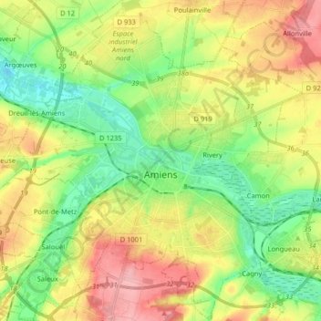
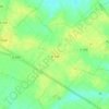
Amiens topographic map

Click on the map to display elevation.

Amiens

The area of the commune is 4,946 hectares (12,220 acres); the altitude varies between 14 and 106 metres (46 and 348 ft).

Wikipedia (CC-BY-SA 3.0)

About this map

Name: Amiens topographic map, elevation, terrain.

Location: Amiens, Somme, Hauts-de-France, Metropolitan France, France (49.84684 2.22356 49.95055 2.34578)

Average elevation: 55 m

Minimum elevation: 9 m

Maximum elevation: 116 m

Other topographic maps

Click on a map to view its topography, its elevation and its terrain.

Petit-Camon

France > Hauts-de-France > Somme > Camon

Average elevation: 73 m

Amiens

France > Hauts-de-France > Somme > Amiens

Average elevation: 86 m

Larronville

France > Hauts-de-France > Somme > Rue

Average elevation: 8 m

Gear up for your next adventure:

🧴Insect Repellent - Protect yourself from bugs during outdoor adventures
🦌Outdoor Trail Camera - Monitor wildlife activity near your favorite spots
🛁Quick-Dry Microfiber Towel - Space-saving towel that dries rapidly on the move
🧭GPS Tracker - Track your location in remote areas safely
🪜Heavy Duty Carabiners - Multi-use clips for securing gear to your backpack

As an Amazon Associate, this site earns from qualifying purchases at no extra cost to you.