Geolocate

Canchayllo topographic map

Click on the map to display elevation.

About this map

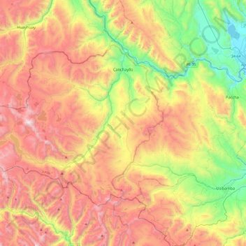
Name: Canchayllo topographic map, elevation, terrain.

Location: Canchayllo, Province of Jauja, Junín, Peru (-12.05963 -76.05326 -11.74678 -75.57975)

Average elevation: 4,215 m

Minimum elevation: 3,353 m

Maximum elevation: 5,168 m

Other topographic maps

Click on a map to view its topography, its elevation and its terrain.

Cañete

Peru > Junín > Mazamari

Average elevation: 737 m

Gear up for your next adventure:

👟Sport Hiking Sandals - Breathable footwear for water crossings and camp rest
🛌Down Sleeping Bag - Superior warmth-to-weight ratio for cold nights
🥫Freeze-Dried Meals - Lightweight, high-calorie nutrition for multi-day treks
🛁Quick-Dry Microfiber Towel - Space-saving towel that dries rapidly on the move
🕶️Polarized Sunglasses - Reduces glare from snow and water at high elevations

As an Amazon Associate, this site earns from qualifying purchases at no extra cost to you.