
Make a donation
Gear up for your next adventure:
As an Amazon Associate, this site earns from qualifying purchases at no extra cost to you.
Campos do Jordão topographic map
Click on the map to display elevation.
Make a donation
Gear up for your next adventure:
As an Amazon Associate, this site earns from qualifying purchases at no extra cost to you.
Campos do Jordão
The city's economy is based mainly on tourism; due to its location at high elevation in the Mantiqueira Mountains, and traditional European-style architecture. Buildings are mostly vernacular architecture from German, Swiss, or Italian models. Many of the wealthiest residents in the state of São Paulo have winter country houses here.
Make a donation
Gear up for your next adventure:
As an Amazon Associate, this site earns from qualifying purchases at no extra cost to you.
About this map
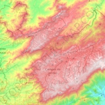
Name: Campos do Jordão topographic map, elevation, terrain.
Average elevation: 1,358 m
Minimum elevation: 598 m
Maximum elevation: 1,954 m
Make a donation
Gear up for your next adventure:
As an Amazon Associate, this site earns from qualifying purchases at no extra cost to you.