Auburn topographic map
Click on the map to display elevation.
Auburn
The southwest and west regions of the city on the plateau are marked by rolling plains and savannahs, with the undeveloped portion primarily being used for cattle grazing and ranching. South of this region sits the coastal plain, with sandy soil and pine forest. Parts of north Auburn have much more rugged topographies, with thick forests in high hills and deep hollows of the type common to parts of eastern Tennessee. The region surrounded by Chewacla Park in the south of the city contains sharp peaks and sudden drops of elevation as the 1.05 billion-year-old rock of the Appalachians meets the coastal plain.
About this map
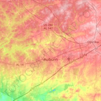
Name: Auburn topographic map, elevation, terrain.
Location: Auburn, Lee County, Alabama, United States (32.52504 -85.58425 32.73063 -85.40447)
Average elevation: 200 m
Minimum elevation: 94 m
Maximum elevation: 267 m
Other topographic maps
Click on a map to view its topography, its elevation and its terrain.