
Make a donation
Gear up for your next adventure:
As an Amazon Associate, this site earns from qualifying purchases at no extra cost to you.
Municipio de Romang topographic map
Click on the map to display elevation.
Make a donation
Gear up for your next adventure:
As an Amazon Associate, this site earns from qualifying purchases at no extra cost to you.
Municipio de Romang
After receiving a complaint about Wingeyer, the provincial government ordered the topographical department to carry out a report (March 27, 1871). On March 15, 1872, the department appointed topographic surveyor, Emilio Goupillaut, to practice the operation said "taking as its starting point at the confluence of the South Stream, [sic] The Worm, property boundary dividing Thompson Bonar and Co."
Make a donation
Gear up for your next adventure:
As an Amazon Associate, this site earns from qualifying purchases at no extra cost to you.
About this map
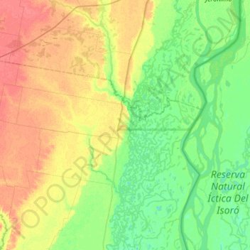
Name: Municipio de Romang topographic map, elevation, terrain.
Average elevation: 39 m
Minimum elevation: 24 m
Maximum elevation: 62 m
Make a donation
Gear up for your next adventure:
As an Amazon Associate, this site earns from qualifying purchases at no extra cost to you.
Other topographic maps
Click on a map to view its topography, its elevation and its terrain.