

Ittigen topographic map
Click on the map to display elevation.
Ittigen
The municipality is located in the Worblental (Worblen valley) on a terrace on the Mannenberg (elevation 688 m [2,257 ft]) in the agglomeration of Bern.
About this map
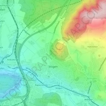
Name: Ittigen topographic map, elevation, terrain.
Average elevation: 595 m
Minimum elevation: 493 m
Maximum elevation: 811 m
Other topographic maps
Click on a map to view its topography, its elevation and its terrain.
Oberdettigen
Switzerland > Bern > Bern-Mittelland administrative district > Hinterkappelen
Average elevation: 566 m
Bern
Switzerland > Bern > Bern-Mittelland administrative district > Bern
Bern is built on very uneven ground. An elevation difference of up to 60 metres exists between the inner city districts on the Aare (Matte, Marzili) and the higher ones (Kirchenfeld, Länggasse).
Average elevation: 643 m