
Thank you for supporting this site ❤️
Make a donation
Make a donation
Gear up for your next adventure:
As an Amazon Associate, this site earns from qualifying purchases at no extra cost to you.
Beyşehir topographic map
Click on the map to display elevation.
Thank you for supporting this site ❤️
Make a donation
Make a donation
Gear up for your next adventure:
As an Amazon Associate, this site earns from qualifying purchases at no extra cost to you.
About this map
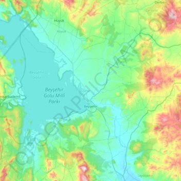
Name: Beyşehir topographic map, elevation, terrain.
Location: Beyşehir, Konya, Central Anatolia Region, 42700, Turkey (37.43107 31.27295 38.02017 31.98470)
Average elevation: 1,336 m
Minimum elevation: 1,101 m
Maximum elevation: 2,399 m
Thank you for supporting this site ❤️
Make a donation
Make a donation
Gear up for your next adventure:
As an Amazon Associate, this site earns from qualifying purchases at no extra cost to you.