
Thank you for supporting this site ❤️
Make a donation
Make a donation
Gear up for your next adventure:
As an Amazon Associate, this site earns from qualifying purchases at no extra cost to you.
Oluvil topographic map
Click on the map to display elevation.
Thank you for supporting this site ❤️
Make a donation
Make a donation
Gear up for your next adventure:
As an Amazon Associate, this site earns from qualifying purchases at no extra cost to you.
About this map
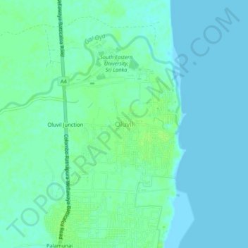
Name: Oluvil topographic map, elevation, terrain.
Location: Oluvil, Ampara District, Eastern Province, 32354, Sri Lanka (7.27053 81.83820 7.31053 81.87820)
Average elevation: 4 m
Minimum elevation: -1 m
Maximum elevation: 9 m
Thank you for supporting this site ❤️
Make a donation
Make a donation
Gear up for your next adventure:
As an Amazon Associate, this site earns from qualifying purchases at no extra cost to you.