
Huamachuco topographic map
Click on the map to display elevation.
Huamachuco
The hamlets at higher elevations (3900–4000 m.) were bases for their herding of domesticated animals, as agriculture could not survive at those heights. The settlements in the lower elevations (2500–3000 m.) contained large amounts of agricultural tools, showing the importance of crops.
About this map
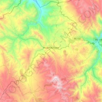
Name: Huamachuco topographic map, elevation, terrain.
Location: Huamachuco, Province of Sánchez Carrión, La Libertad, Peru (-7.95735 -78.18765 -7.69427 -77.88111)
Average elevation: 3,359 m
Minimum elevation: 2,231 m
Maximum elevation: 4,720 m