Geolocate

Greenville topographic map

Click on the map to display elevation.

About this map

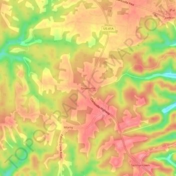
Name: Greenville topographic map, elevation, terrain.

Location: Greenville, Nashville-Davidson, Davidson County, Middle Tennessee, Tennessee, 37080, United States (36.27700 -86.90833 36.31700 -86.86833)

Average elevation: 239 m

Minimum elevation: 181 m

Maximum elevation: 269 m

Other topographic maps

Click on a map to view its topography, its elevation and its terrain.

Gear up for your next adventure:

🧴Bear Spray Holster - Quick-access carry for essential Canadian wilderness safety
🥾Light Trekking Boots - Supportive boots for multi-day treks
🎒Fully Waterproof Backpack - Total protection for photography gear and electronics
🥾Waterproof Hiking Shoes - Durable shoes for wet and rugged trails
🛌Down Sleeping Bag - Superior warmth-to-weight ratio for cold nights

As an Amazon Associate, this site earns from qualifying purchases at no extra cost to you.