
Graswang topographic map
Click on the map to display elevation.
About this map
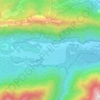
Name: Graswang topographic map, elevation, terrain.
Average elevation: 1,140 m
Minimum elevation: 844 m
Maximum elevation: 1,877 m
Other topographic maps
Click on a map to view its topography, its elevation and its terrain.
Soiernsee
Germany > Bavaria > Landkreis Garmisch-Partenkirchen > Mittenwald
Average elevation: 1,766 m
Staffelsee
Germany > Bavaria > Landkreis Garmisch-Partenkirchen > Seehausen am Staffelsee
Average elevation: 661 m