Geolocate

Sequim topographic map

Click on the map to display elevation.

About this map

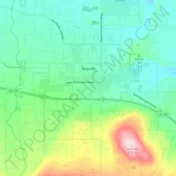
Name: Sequim topographic map, elevation, terrain.

Location: Sequim, Clallam County, Washington, United States (48.05473 -123.14111 48.09995 -123.04036)

Average elevation: 88 m

Minimum elevation: 1 m

Maximum elevation: 314 m

Other topographic maps

Click on a map to view its topography, its elevation and its terrain.

Gear up for your next adventure:

🧢Hiking Hat - Sun-protective and breathable hats for long treks
🧥Waterproof Pants - Keep dry during rainy hiking conditions
🔥Emergency Fire Starter - Reliable ignition source for all weather conditions
🏃Hydration Running Vest - Carry water and maps close to your body for speed
🧴Outdoor Sunscreen - High SPF protection for high-altitude UV exposure

As an Amazon Associate, this site earns from qualifying purchases at no extra cost to you.