
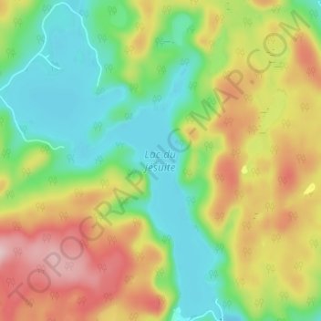
Lac du Jésuite topographic map
Interactive map
Click on the map to display elevation.
About this map
Name: Lac du Jésuite topographic map, elevation, terrain.
Average elevation: 288 m
Minimum elevation: 195 m
Maximum elevation: 420 m
Other topographic maps
Click on a map to view its topography, its elevation and its terrain.
Lac Le Jeune
Canada > Quebec > Mékinac > Sainte-Thècle
Lac Le Jeune, Sainte-Thècle, Mékinac, Mauricie, Quebec, Canada
Average elevation: 346 m