
Thank you for supporting this site ❤️
Make a donation
Make a donation
Gear up for your next adventure:
As an Amazon Associate, this site earns from qualifying purchases at no extra cost to you.
Fonte La Spugna topographic map
Click on the map to display elevation.
Thank you for supporting this site ❤️
Make a donation
Make a donation
Gear up for your next adventure:
As an Amazon Associate, this site earns from qualifying purchases at no extra cost to you.
About this map
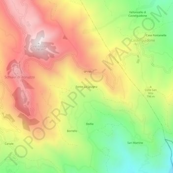
Name: Fonte La Spugna topographic map, elevation, terrain.
Location: Fonte La Spugna, Schiavi di Abruzzo, Chieti, 66045, Italy (41.79289 14.48657 41.83289 14.52657)
Average elevation: 805 m
Minimum elevation: 312 m
Maximum elevation: 1,269 m
Thank you for supporting this site ❤️
Make a donation
Make a donation
Gear up for your next adventure:
As an Amazon Associate, this site earns from qualifying purchases at no extra cost to you.