
Thank you for supporting this site ❤️
Make a donation
Make a donation
Gear up for your next adventure:
As an Amazon Associate, this site earns from qualifying purchases at no extra cost to you.
Sethan topographic map
Click on the map to display elevation.
Thank you for supporting this site ❤️
Make a donation
Make a donation
Gear up for your next adventure:
As an Amazon Associate, this site earns from qualifying purchases at no extra cost to you.
About this map
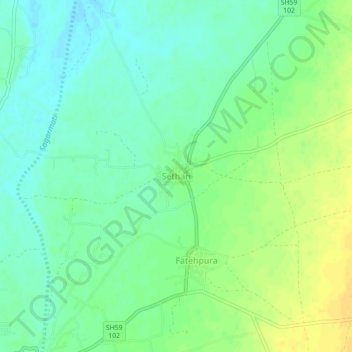
Name: Sethan topographic map, elevation, terrain.
Location: Sethan, Peesangan Tehsil, Ajmer, Rajasthan, 305201, India (26.40051 74.38127 26.44051 74.42127)
Average elevation: 398 m
Minimum elevation: 387 m
Maximum elevation: 413 m
Thank you for supporting this site ❤️
Make a donation
Make a donation
Gear up for your next adventure:
As an Amazon Associate, this site earns from qualifying purchases at no extra cost to you.