Geolocate

Dharamkot topographic map

Click on the map to display elevation.

About this map

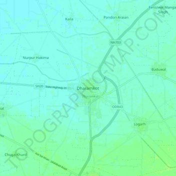
Name: Dharamkot topographic map, elevation, terrain.

Location: Dharamkot, Dharamkot Tahsil, Moga, Punjab, 142042, India (30.90321 75.19278 30.98321 75.27278)

Average elevation: 222 m

Minimum elevation: 218 m

Maximum elevation: 228 m

Gear up for your next adventure:

💡Portable Camping Lamp - Rechargeable lamp for campsite lighting
🕶️Polarized Sunglasses - Reduces glare from snow and water at high elevations
🛏️Sleeping Bag - Warm and compact sleeping bags for outdoor camping
🐕Hiking Dog Pack - Let your canine companion carry their own water and food
🥾Mountain Hiking Boots - High-traction boots for rocky terrain

As an Amazon Associate, this site earns from qualifying purchases at no extra cost to you.