Geolocate

Norwalk topographic map

Click on the map to display elevation.

About this map

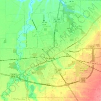
Name: Norwalk topographic map, elevation, terrain.

Location: Norwalk, Huron County, Ohio, 44857, United States (41.21821 -82.65921 41.27829 -82.55834)

Average elevation: 222 m

Minimum elevation: 185 m

Maximum elevation: 270 m

Gear up for your next adventure:

🧭GPS Outdoor Watch - Smart watch for navigation and fitness tracking in nature
🧥Packable Rain Jacket - Breathable waterproof layer for unpredictable weather
🔦UV Flashlight - Detect minerals or specific insects in the dark
🧥Waterproof Pants - Keep dry during rainy hiking conditions
🔨Vehicle Emergency Tool - Safety tool for remote road trips to trailheads

As an Amazon Associate, this site earns from qualifying purchases at no extra cost to you.