Geolocate

Yichang topographic map

Click on the map to display elevation.

About this map

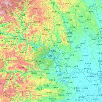
Name: Yichang topographic map, elevation, terrain.

Location: Yichang, Hubei, China (29.94557 110.25026 31.58139 112.08053)

Average elevation: 592 m

Minimum elevation: 27 m

Maximum elevation: 2,833 m

Other topographic maps

Click on a map to view its topography, its elevation and its terrain.

Jianshi

China > Hubei > Jianshi County > Jianshi

Average elevation: 1,018 m

Gear up for your next adventure:

🎒Fully Waterproof Backpack - Total protection for photography gear and electronics
🥾Trail Hiking Socks - Comfortable socks to prevent blisters and fatigue
🥾Waterproof Hiking Boots - Essential footwear for rugged terrain and wet Canadian trails
🛶Kayak Dry Bag - Waterproof storage for kayaking adventures
Bushcraft Tarp - Versatile emergency shelter or gear protection

As an Amazon Associate, this site earns from qualifying purchases at no extra cost to you.