Geolocate

Virac topographic map

Click on the map to display elevation.

About this map

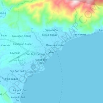
Name: Virac topographic map, elevation, terrain.

Location: Virac, Catanduanes, Bicol Region, 4800, Philippines (13.54082 124.19106 13.62082 124.27106)

Average elevation: 78 m

Minimum elevation: -5 m

Maximum elevation: 683 m

Gear up for your next adventure:

🧦Thermal Socks - Warm socks for winter hiking or camping
🔦LED Headlamp - Hands-free lighting for early morning starts or late finishes
💡Portable Camping Lamp - Rechargeable lamp for campsite lighting
🔪Outdoor Multitool - Versatile tool for repairs and food prep in the wild
🧥Insulated Jacket - Keep warm in cold outdoor conditions

As an Amazon Associate, this site earns from qualifying purchases at no extra cost to you.