Essonne topographic map
Click on the map to display elevation.
About this map
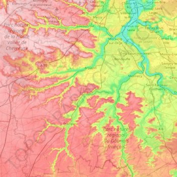
Name: Essonne topographic map, elevation, terrain.
Location: Essonne, Ile-de-France, Metropolitan France, France (48.28459 1.91446 48.77613 2.58530)
Average elevation: 115 m
Minimum elevation: 30 m
Maximum elevation: 181 m
Other topographic maps
Click on a map to view its topography, its elevation and its terrain.

Bois Grillots
France > Ile-de-France > Seine-et-Marne > Moret-Loing-et-Orvanne
Average elevation: 79 m