
Thank you for supporting this site ❤️
Make a donation
Make a donation
Gear up for your next adventure:
As an Amazon Associate, this site earns from qualifying purchases at no extra cost to you.
Scurzolengo topographic map
Click on the map to display elevation.
Thank you for supporting this site ❤️
Make a donation
Make a donation
Gear up for your next adventure:
As an Amazon Associate, this site earns from qualifying purchases at no extra cost to you.
About this map
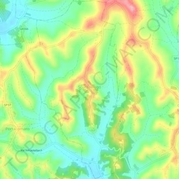
Name: Scurzolengo topographic map, elevation, terrain.
Location: Scurzolengo, Asti, Piedmont, Italy (44.94738 8.26041 44.98312 8.28830)
Average elevation: 198 m
Minimum elevation: 145 m
Maximum elevation: 278 m
Thank you for supporting this site ❤️
Make a donation
Make a donation
Gear up for your next adventure:
As an Amazon Associate, this site earns from qualifying purchases at no extra cost to you.