Geolocate

Icking topographic map

Click on the map to display elevation.

About this map

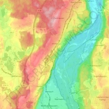
Name: Icking topographic map, elevation, terrain.

Location: Icking, Landkreis Bad Tölz-Wolfratshausen, Bavaria, 82057, Germany (47.90825 11.38926 47.98021 11.46305)

Average elevation: 635 m

Minimum elevation: 548 m

Maximum elevation: 729 m

Other topographic maps

Click on a map to view its topography, its elevation and its terrain.

Gear up for your next adventure:

💧Hydration Pack - Hands-free hydration system for long hikes
🥾Approach Boots - Comfortable boots for hiking and climbing approaches
🥾Trail Hiking Socks - Comfortable socks to prevent blisters and fatigue
🥾All-Terrain Hiking Boots - Versatile boots for varied hiking conditions
🧴Sunscreen SPF - Broad-spectrum sunscreen for outdoor activities

As an Amazon Associate, this site earns from qualifying purchases at no extra cost to you.