Geolocate

Lofer topographic map

Click on the map to display elevation.

About this map

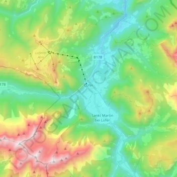
Name: Lofer topographic map, elevation, terrain.

Location: Lofer, Bezirk Zell am See, Salzburg, 5090, Austria (47.53642 12.62818 47.63280 12.79541)

Average elevation: 1,155 m

Minimum elevation: 546 m

Maximum elevation: 2,481 m

Gear up for your next adventure:

🧦Crew Hiking Socks - Comfortable socks for long-distance hikes
🔥Camping Stove - Portable stoves to cook outdoors with ease
🎒Hiking Backpack - Lightweight and ergonomic backpacks for day hikes or multi-day treks
🛁Quick-Dry Microfiber Towel - Space-saving towel that dries rapidly on the move
💧Reusable Water Bottle - Durable water bottles for hydration on trails

As an Amazon Associate, this site earns from qualifying purchases at no extra cost to you.