Geolocate

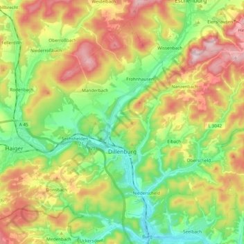
Dillenburg topographic map

Click on the map to display elevation.

Dillenburg

Nanzenbach lies approximately 6 km north of the main town of Dillenburg. The tallest mountain of Dillenburg, the Eschenburg at an elevation of 589 m, is part of the Nanzenbach area.

Wikipedia (CC-BY-SA 3.0)

About this map

Name: Dillenburg topographic map, elevation, terrain.

Location: Dillenburg, Lahn-Dill-Kreis, Hesse, Germany (50.70545 8.20416 50.80417 8.39238)

Average elevation: 373 m

Minimum elevation: 207 m

Maximum elevation: 589 m

Gear up for your next adventure:

🥾Lightweight Hiking Boots - Boots for comfort and mobility on long hikes
🥾Approach Boots - Comfortable boots for hiking and climbing approaches
🧢Hiking Hat - Sun-protective and breathable hats for long treks
🗺️Topographic Maps - Detailed maps to explore trails, mountains, and wilderness areas
🥾Waterproof Hiking Boots - Essential footwear for rugged terrain and wet Canadian trails

As an Amazon Associate, this site earns from qualifying purchases at no extra cost to you.