
Mount Sutton topographic map
Click on the map to display elevation.
About this map
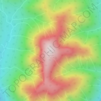
Name: Mount Sutton topographic map, elevation, terrain.
Average elevation: 717 m
Minimum elevation: 359 m
Maximum elevation: 1,158 m
Cowichan Valley Regional District trails, hiking, mountain biking, running and outdoor activities
Other topographic maps
Click on a map to view its topography, its elevation and its terrain.
Pacific Marine
Canada > British Columbia > Cowichan Valley Regional District > Area F (Cowichan Lake South / Skutz Falls)
Average elevation: 256 m