

Chico River topographic map
Click on the map to display elevation.
Chico River
The Chico River, has a total length of 233 kilometres (145 mi), making it the longest tributary of the Cagayan River, itself the largest river in the Philippines. For centuries it has been central to farming, trading, livelihoods, and daily life, whether as a benefit or hindrance. It provided a source of water for washing and irrigation, and habitat for carabao who had to be led to a watering hole daily. At times it might be an obstacle to settlements on the other side of the river, but until the last century this was an opportunity for enterprising Filipinos who would provide ferry transport. Now, bridges suitable for vehicles have been built. The danger of flooding was less frequent due to being at a higher elevation than the bigger, flood-prone Cagayan into which it feeds.
About this map
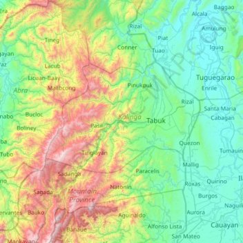
Name: Chico River topographic map, elevation, terrain.
Average elevation: 585 m
Minimum elevation: 2 m
Maximum elevation: 2,657 m