
Thank you for supporting this site ❤️
Make a donation
Make a donation
Gear up for your next adventure:
As an Amazon Associate, this site earns from qualifying purchases at no extra cost to you.
Melukote topographic map
Click on the map to display elevation.
Thank you for supporting this site ❤️
Make a donation
Make a donation
Gear up for your next adventure:
As an Amazon Associate, this site earns from qualifying purchases at no extra cost to you.
About this map
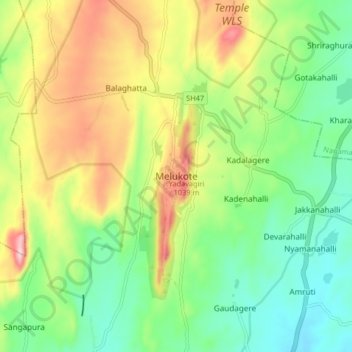
Name: Melukote topographic map, elevation, terrain.
Location: Melukote, Pandavapura taluk, Mandya, Karnataka, 571431, India (12.62241 76.60965 12.70241 76.68965)
Average elevation: 920 m
Minimum elevation: 802 m
Maximum elevation: 1,111 m
Thank you for supporting this site ❤️
Make a donation
Make a donation
Gear up for your next adventure:
As an Amazon Associate, this site earns from qualifying purchases at no extra cost to you.