Geolocate

Huntingville topographic map

Click on the map to display elevation.

About this map
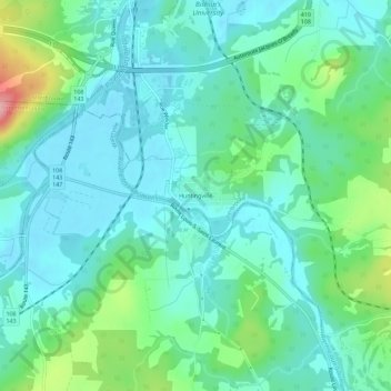
Name: Huntingville topographic map, elevation, terrain.

Location: Huntingville, Lennoxville, Sherbrooke, Quebec, J1M 0C1, Canada (45.32045 -71.86790 45.36045 -71.82790)

Average elevation: 177 m

Minimum elevation: 144 m

Maximum elevation: 290 m

Quebec trails, hiking, mountain biking, running and outdoor activities

Other topographic maps

Click on a map to view its topography, its elevation and its terrain.

Lennoxville

Canada > Quebec > Sherbrooke

Average elevation: 212 m

Parc du Bois-Beckett

Canada > Quebec > Sherbrooke

Average elevation: 214 m

Brompton

Canada > Quebec > Sherbrooke

Average elevation: 213 m

Gear up for your next adventure:

🦶Anti-Blister Balm - Prevents friction and hotspots during long ascents
🥾Trail Running Shoes - Lightweight and durable shoes for trail running
🔋Solar Power Bank - Keep your GPS and devices charged during long outdoor trips
🧥Softshell Jacket - Windproof and breathable jacket for hiking
🥾Trekking Poles - Adjustable trekking poles to reduce knee stress and improve stability

As an Amazon Associate, this site earns from qualifying purchases at no extra cost to you.