Geolocate

Vellinge kommun topographic map

Click on the map to display elevation.

About this map

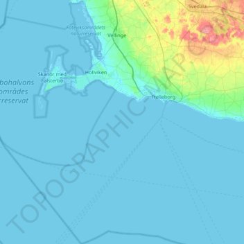
Name: Vellinge kommun topographic map, elevation, terrain.

Location: Vellinge kommun, Skåne County, Sweden (55.14837 12.60942 55.52417 13.18032)

Average elevation: 8 m

Minimum elevation: -3 m

Maximum elevation: 100 m

Other topographic maps

Click on a map to view its topography, its elevation and its terrain.

Vitaby

Sweden > Skåne County

Average elevation: 106 m

Hänninge

Sweden > Skåne County > Hänninge

Average elevation: 68 m

Gear up for your next adventure:

🧰Multitool Knife - Compact and versatile tool for outdoor use
🥾Hiking Gaiters - Protect legs and shoes from mud, snow, and debris
📷Outdoor Action Camera - Capture high-elevation views and rugged adventures
🥾Hiking Shorts - Breathable shorts suitable for summer hikes
🥾Mountain Hiking Shoes - Shoes with superior grip for mountainous terrain

As an Amazon Associate, this site earns from qualifying purchases at no extra cost to you.