Geolocate

Barrington topographic map

Click on the map to display elevation.

About this map
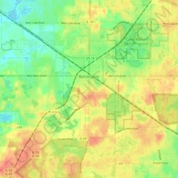
Name: Barrington topographic map, elevation, terrain.

Location: Barrington, Barrington Township, Cook County, Illinois, United States (42.12824 -88.15937 42.16906 -88.06002)

Average elevation: 258 m

Minimum elevation: 233 m

Maximum elevation: 280 m

Other topographic maps

Click on a map to view its topography, its elevation and its terrain.
Symphony Lake

United States > Illinois > Cook County > Chicago

Average elevation: 181 m

Gear up for your next adventure:

🌡️Emergency Mylar Blankets - Compact thermal protection for unexpected nights outdoors
🧥Ultralight Puffy Jacket - Maximum warmth that packs down to the size of an orange
🦶Hiking Shoe Insoles - Added support for high arches and long days on feet
🩹Moleskin Blister Pads - Direct protection for painful foot pressure points
🚲MTB Frame Bag - Carry tools and maps directly on your bicycle frame

As an Amazon Associate, this site earns from qualifying purchases at no extra cost to you.