

Saint-Denis topographic map
Click on the map to display elevation.
Saint-Denis
The city is located on the north end of the island, and was a port. Saint-Denis was "originally the main port of Réunion, but an artificial harbour at Le Port, on the northwest coast, replaced it in the 1880s, because of unpredictable winds and tides at Saint-Denis." The city includes some of the island's mountains, with a peak elevation of 2,276 meters (7,467 ft) within the metro area, which begins at sea level at the coast line.
About this map
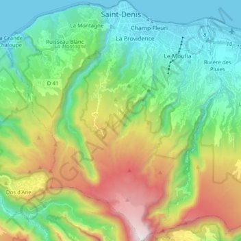
Name: Saint-Denis topographic map, elevation, terrain.
Location: Saint-Denis, Réunion, France (-21.01505 55.37563 -20.87174 55.51269)
Average elevation: 722 m
Minimum elevation: 0 m
Maximum elevation: 2,266 m