
Thank you for supporting this site ❤️
Make a donation
Make a donation
Gear up for your next adventure:
As an Amazon Associate, this site earns from qualifying purchases at no extra cost to you.
Wallroth topographic map
Click on the map to display elevation.
Thank you for supporting this site ❤️
Make a donation
Make a donation
Gear up for your next adventure:
As an Amazon Associate, this site earns from qualifying purchases at no extra cost to you.
About this map
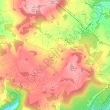
Name: Wallroth topographic map, elevation, terrain.
Location: Wallroth, Schlüchtern, Main-Kinzig-Kreis, Hesse, Germany (50.37529 9.46769 50.41132 9.52232)
Average elevation: 406 m
Minimum elevation: 284 m
Maximum elevation: 475 m
Thank you for supporting this site ❤️
Make a donation
Make a donation
Gear up for your next adventure:
As an Amazon Associate, this site earns from qualifying purchases at no extra cost to you.