Geolocate

Bitburg topographic map

Click on the map to display elevation.

About this map
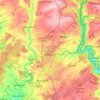
Name: Bitburg topographic map, elevation, terrain.

Location: Bitburg, Eifelkreis Bitburg-Prüm, Rhineland-Palatinate, Germany (49.93519 6.45161 50.01873 6.58925)

Average elevation: 326 m

Minimum elevation: 202 m

Maximum elevation: 416 m

Gear up for your next adventure:

🧴First Aid Kit - Essential first aid supplies for outdoor emergencies
🔦LED Headtorch - Bright and durable light for night activities
🐕Hiking Dog Pack - Let your canine companion carry their own water and food
🛶Waterproof Dry Bags - Keep electronics and clothes dry during river crossings
🧼Biodegradable Camp Soap - Environmentally friendly cleaning for gear and body

As an Amazon Associate, this site earns from qualifying purchases at no extra cost to you.