Geolocate

Amos topographic map

Click on the map to display elevation.

About this map
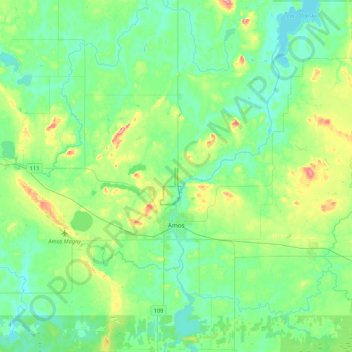
Name: Amos topographic map, elevation, terrain.

Location: Amos, Abitibi, Abitibi-Témiscamingue, Quebec, Canada (48.50221 -78.22408 48.71955 -77.79997)

Average elevation: 313 m

Minimum elevation: 287 m

Maximum elevation: 396 m

Abitibi trails, hiking, mountain biking, running and outdoor activities

Gear up for your next adventure:

🧥Insulated Jacket - Keep warm in cold outdoor conditions
🐕Hiking Dog Pack - Let your canine companion carry their own water and food
🥾Mountain Hiking Shoes - Shoes with superior grip for mountainous terrain
🥤Collapsible Travel Cup - Saves space and weight in your mess kit
🧴Waterproofing Spray - Restore the DWR coating on jackets and tents

As an Amazon Associate, this site earns from qualifying purchases at no extra cost to you.