Geolocate

Alcover topographic map

Click on the map to display elevation.

About this map

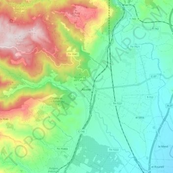
Name: Alcover topographic map, elevation, terrain.

Location: Alcover, Alt Camp, Tarragona, Catalonia, 43460, Spain (41.22348 1.09847 41.30543 1.21558)

Average elevation: 331 m

Minimum elevation: 94 m

Maximum elevation: 837 m

Gear up for your next adventure:

Camping Groundsheet - Protect your tent from moisture and dirt
🔭Compact Binoculars - Lightweight optics for scouting trails and wildlife
🔥Emergency Fire Starter - Reliable ignition source for all weather conditions
🧭Orienteering Kit - Tools for map reading and navigation in the wild
🛌Down Sleeping Bag - Superior warmth-to-weight ratio for cold nights

As an Amazon Associate, this site earns from qualifying purchases at no extra cost to you.