
Thank you for supporting this site ❤️
Make a donation
Make a donation
Gear up for your next adventure:
As an Amazon Associate, this site earns from qualifying purchases at no extra cost to you.
Trois-Rivières topographic map
Click on the map to display elevation.
Thank you for supporting this site ❤️
Make a donation
Make a donation
Gear up for your next adventure:
As an Amazon Associate, this site earns from qualifying purchases at no extra cost to you.
About this map
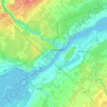
Name: Trois-Rivières topographic map, elevation, terrain.
Location: Trois-Rivières, Mauricie, Quebec, G9A 2H1, Canada (46.18323 -72.70285 46.50323 -72.38285)
Average elevation: 38 m
Minimum elevation: 1 m
Maximum elevation: 191 m
Trois-Rivières trails, hiking, mountain biking, running and outdoor activities
Thank you for supporting this site ❤️
Make a donation
Make a donation
Gear up for your next adventure:
As an Amazon Associate, this site earns from qualifying purchases at no extra cost to you.