
Thank you for supporting this site ❤️
Make a donation
Make a donation
Gear up for your next adventure:
As an Amazon Associate, this site earns from qualifying purchases at no extra cost to you.
Braås topographic map
Click on the map to display elevation.
Thank you for supporting this site ❤️
Make a donation
Make a donation
Gear up for your next adventure:
As an Amazon Associate, this site earns from qualifying purchases at no extra cost to you.
About this map
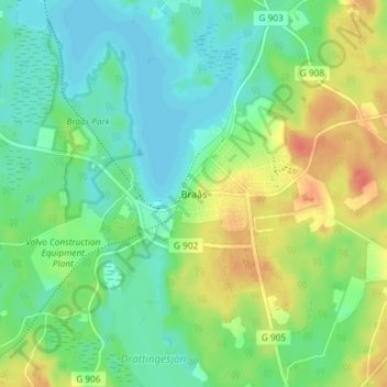
Name: Braås topographic map, elevation, terrain.
Location: Braås, Växjö kommun, Kronoberg County, 363 42, Sweden (57.03979 15.02836 57.07979 15.06836)
Average elevation: 200 m
Minimum elevation: 183 m
Maximum elevation: 229 m
Thank you for supporting this site ❤️
Make a donation
Make a donation
Gear up for your next adventure:
As an Amazon Associate, this site earns from qualifying purchases at no extra cost to you.