
Thank you for supporting this site ❤️
Make a donation
Make a donation
Gear up for your next adventure:
As an Amazon Associate, this site earns from qualifying purchases at no extra cost to you.
IJsselmonde topographic map
Click on the map to display elevation.
Thank you for supporting this site ❤️
Make a donation
Make a donation
Gear up for your next adventure:
As an Amazon Associate, this site earns from qualifying purchases at no extra cost to you.
About this map
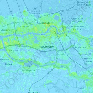
Name: IJsselmonde topographic map, elevation, terrain.
Location: IJsselmonde, South Holland, Netherlands (51.83093 4.32408 51.91553 4.65241)
Average elevation: 1 m
Minimum elevation: -8 m
Maximum elevation: 17 m
Thank you for supporting this site ❤️
Make a donation
Make a donation
Gear up for your next adventure:
As an Amazon Associate, this site earns from qualifying purchases at no extra cost to you.