Geolocate

Lagrimone topographic map

Click on the map to display elevation.

About this map
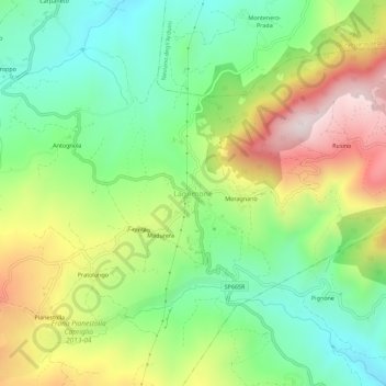
Name: Lagrimone topographic map, elevation, terrain.

Location: Lagrimone, Tizzano Val Parma, Parma, Emilia-Romagna, 43028, Italy (44.47482 10.21898 44.51482 10.25898)

Average elevation: 720 m

Minimum elevation: 461 m

Maximum elevation: 1,122 m

Other topographic maps

Click on a map to view its topography, its elevation and its terrain.

Berceto

Italy > Emilia-Romagna > Parma

Average elevation: 767 m

Albareto

Italy > Emilia-Romagna > Parma

Average elevation: 820 m

Gear up for your next adventure:

🥾Trail Running Boots - Durable shoes designed for trail running
🪜Heavy Duty Carabiners - Multi-use clips for securing gear to your backpack
🪑Insulated Seat Pad - Protect your seat from cold rocks and wet logs
⛺Backpacking Tent - Lightweight tent for long-distance hiking trips
🥾Approach Boots - Comfortable boots for hiking and climbing approaches

As an Amazon Associate, this site earns from qualifying purchases at no extra cost to you.