
Oravița topographic map
Interactive map
Click on the map to display elevation.
About this map
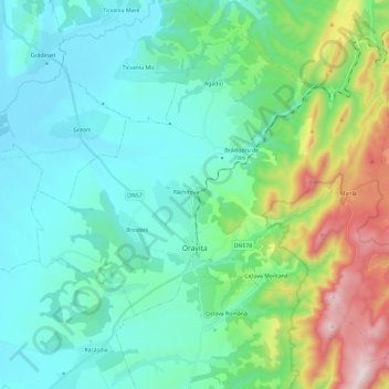
Name: Oravița topographic map, elevation, terrain.
Location: Oravița, Caraș-Severin, Romania (44.98868 21.58622 45.13313 21.82352)
Average elevation: 302 m
Minimum elevation: 100 m
Maximum elevation: 1,030 m
Other topographic maps
Click on a map to view its topography, its elevation and its terrain.