
Thank you for supporting this site ❤️
Make a donation
Make a donation
Gear up for your next adventure:
As an Amazon Associate, this site earns from qualifying purchases at no extra cost to you.
Qu'nyido topographic map
Click on the map to display elevation.
Thank you for supporting this site ❤️
Make a donation
Make a donation
Gear up for your next adventure:
As an Amazon Associate, this site earns from qualifying purchases at no extra cost to you.
About this map
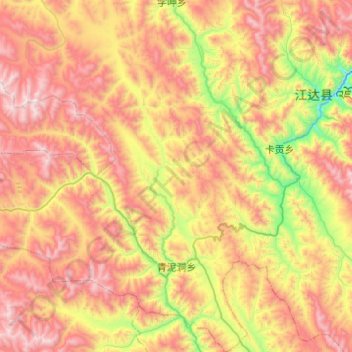
Name: Qu'nyido topographic map, elevation, terrain.
Location: Qu'nyido, Jomda County, Chamdo City, Tibet, China (31.19247 97.69058 31.61092 98.09100)
Average elevation: 4,324 m
Minimum elevation: 3,555 m
Maximum elevation: 5,143 m
Thank you for supporting this site ❤️
Make a donation
Make a donation
Gear up for your next adventure:
As an Amazon Associate, this site earns from qualifying purchases at no extra cost to you.