Geolocate

Exmouth topographic map

Click on the map to display elevation.

About this map

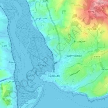
Name: Exmouth topographic map, elevation, terrain.

Location: Exmouth, East Devon, Devon, England, United Kingdom (50.60502 -3.43757 50.65575 -3.34895)

Average elevation: 29 m

Minimum elevation: -3 m

Maximum elevation: 164 m

Gear up for your next adventure:

🍽️Titanium Camping Spork - Ultralight and indestructible eating utensil
🥾Trekking Poles - Adjustable trekking poles to reduce knee stress and improve stability
🧰Survival Kit - Essential gear for emergencies in the wilderness
🎒Hiking Daypack - Lightweight and durable backpacks for day trips and excursions
Camping Coffee Maker - Brew fresh coffee anywhere on the topographic map

As an Amazon Associate, this site earns from qualifying purchases at no extra cost to you.