

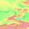
Tian Shan topographic map
Click on the map to display elevation.
Tian Shan
The Torugart Pass, at 3,752 metres (12,310 ft), marks the border between Kyrgyzstan and Xinjiang. The lower-altitude, forested Alatau ranges in the northern Tian Shan is home to Turkic-speaking pastoral tribes.
About this map
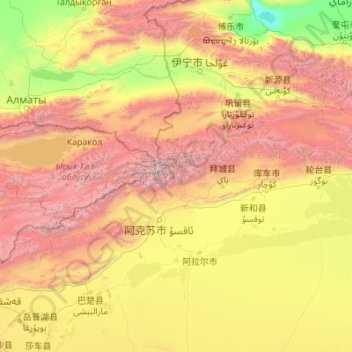
Name: Tian Shan topographic map, elevation, terrain.
Location: Tian Shan, China (41.32734 76.33299 42.60164 85.12205)
Average elevation: 1,689 m
Minimum elevation: 193 m
Maximum elevation: 7,035 m
Other topographic maps
Click on a map to view its topography, its elevation and its terrain.
Broad Peak
China > Xinjiang > Taxkorgan Tajik Autonomous County > Dafdar
Broad Peak is one of the eight-thousanders, and is located in the Karakoram range spanning Gilgit-Baltistan, Pakistan and Xinjiang, China. It is the 12th highest mountain in the world at 8,051 metres (26,414 ft) elevation above sea level. The first ascent of this mountain was in June 1957, accomplished by…
Average elevation: 7,117 m
Chongqing
The central urban area of Chongqing, or Chongqing proper, is a city of unique features. Built on mountains and partially surrounded by the Yangtze and Jialing rivers, it is known as a "mountain city" and a "city on rivers". The night scene of the city is very illuminated, with millions of lights and their…
Average elevation: 318 m
Shanghai
The golden age of Shanghai began with its elevation to municipality on 7 July 1927. This new Chinese municipality covered an area of 494.69 km2 (191.0 sq mi), including the modern-day districts of Baoshan, Yangpu, Zhabei, Nanshi, and Pudong, but excluded the foreign concessions territories. Headed by a Chinese…
Average elevation: 5 m


Yunnan
Yunnan is situated in a mountainous area, with high elevations in the northwest and low elevations in the southeast. Most of the population lives in the eastern part of the province. In the west, the altitude can vary from the mountain peaks to river valleys by as much as 3,000 m (9,800 ft). Yunnan is rich in…
Average elevation: 1,713 m
Beijing
Beijing is situated at the northern tip of the roughly triangular North China Plain, which opens to the south and east of the city. Mountains to the north, northwest and west shield the city and northern China's agricultural heartland from the encroaching desert steppes. The northwestern part of the…
Average elevation: 460 m
Xinjiang
A semiarid or desert climate (Köppen BSk or BWk, respectively) prevails in Xinjiang. The entire region has great seasonal differences in temperature with cold winters. The Turpan Depression recorded the hottest temperatures nationwide in summer, with air temperatures easily exceeding 40 °C (104 °F). Winter…
Average elevation: 2,188 m

Beijing
Beijing is situated at the northern tip of the roughly triangular North China Plain, which opens to the south and east of the city. Mountains to the north, northwest and west shield the city and northern China's agricultural heartland from the encroaching desert steppes. The northwestern part of the…
Average elevation: 460 m





Sichuan
Due to great differences in terrain, the climate of the province is highly variable. In general, it has strong monsoonal influences, with rainfall heavily concentrated in the summer. Under the Köppen climate classification, the Sichuan Basin (including Chengdu) in the eastern half of the province experiences…
Average elevation: 2,522 m


Hong Kong
Hong Kong has a humid subtropical climate (Köppen Cwa), characteristic of southern China, despite being located south of the Tropic of Cancer. Summers are long, hot and humid, with occasional showers and thunderstorms and warm air from the southwest. The humid nature of Hong Kong exacerbates the warmth of…
Average elevation: 47 m
Mount Kailash
China > Tibet > Purang County > Darchen
Mount Kailash (also Kailasa; Kangrinboqê or Gang Rinpoche; Tibetan: གངས་རིན་པོ་ཆེ; simplified Chinese: 冈仁波齐峰; traditional Chinese: 岡仁波齊峰; Sanskrit: कैलास, IAST: Kailāsa), is a mountain in the Ngari Prefecture, Tibet Autonomous Region of China. It has an…
Average elevation: 5,756 m
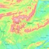

Changshou District
Changshou is located in 106°49’22” E – 107°27’30”E of longitude and 29°43’ N – 30°12’30”N of latitude, and is 56.56 km (35.14 mi) wide from south to north, and 57.5 km (35.7 mi) long from east to west. The altitude in the area is between 154 to 1,034.2 m (505 to 3,393 ft). Changshou is…
Average elevation: 401 m
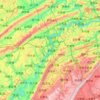
Wanzhou
Wanzhou spans 30°24′−31°14′ N latitude and 107°55′−108°53′ E longitude, and is situated at the eastern edge of the Sichuan Basin. It reaches a maximal north–south extent of 67.25 km (41.79 mi) and east–west width of 97.25 km (60.43 mi), covering an area of 3,214 km2 (1,241 sq mi).…
Average elevation: 651 m


Anhui
Anhui is topographically diverse. The north is part of the North China Plain while the north-central areas are part of the Huai River watershed. Both regions are flat, and densely populated. The land becomes more uneven further south, with the Dabie Mountains occupying much of southwestern Anhui and a series…
Average elevation: 99 m

Mount Hua South Peak
China > Shaanxi > Weinan City
The East peak consists of four summits. The highest summit is Zhaoyang Feng (朝陽峰, Facing Yang Summit, i.e. the summit facing the sun). Its elevation is reported to be 2,096 m (6,877 ft) and its name is often used as the name for the whole East Peak. To the east of Zhaoyang Feng is Shilou Feng (石樓峰,…
Average elevation: 1,498 m
Kunming
Kunming (/kʊnˈmɪŋ/;[3] Chinese: 昆明; pinyin: Kūnmíng), also known as Yunnan-Fu, is the capital and largest city of Yunnan province, China.[4] It is the political, economic, communications and cultural centre of the province as well as the seat of the provincial government. The headquarters of many of…
Average elevation: 1,996 m



Mainling City
Mainling is located in the central-west of the Nyingtri Prefecture, at the middle reaches of the Yarlung Tsangpo River, and between the Nyenchen Tanglha Mountains and the Himalayan Mountains. It de jure covers an area of 9,490 square kilometres, including the area claimed but de facto under control of the…
Average elevation: 3,611 m
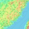
Fujian
The province is mostly mountainous and is traditionally said to be "eight parts mountain, one part water, and one part farmland" (八山一水一分田). The northwest is higher in altitude, with the Wuyi Mountains forming the border between Fujian and Jiangxi. It is the most forested provincial-level…
Average elevation: 302 m
Heilongjiang
Heilongjiang is a land of varied topographies. Much of the province is dominated by mountain ranges such as the Greater Khingan Range and Lesser Khingan Range, Zhangguangcai Mountains, Laoye Mountains, and Wanda Mountains. The highest peak is Datudingzi Mountain at 1,690 metres (5,540 ft), located on the…
Average elevation: 417 m
Gansu
Gansu generally has a semi-arid to arid continental climate (Köppen BSk or BWk) with warm to hot summers and cold to very cold winters, although diurnal temperature ranges are often so large that maxima remain above 0 °C (32 °F) even in winter. However, due to extreme altitude, some areas of Gansu exhibit a…
Average elevation: 2,260 m
Guangdong
Guangdong faces the South China Sea to the south and has a total of 4,300 km (2,700 mi) of coastline. The Leizhou Peninsula is on the southwestern end of the province. There are a few inactive volcanoes on Leizhou Peninsula. The Pearl River Delta is the convergent point of three upstream rivers: the East…
Average elevation: 193 m
Hebei
Hebei is the only province in China to contain plateaus, mountains, hills, shorelines, plains, and lakes. Most of central and southern Hebei lies within the North China Plain. Western Hebei rises into the Taihang Mountains (Taihang Shan), while the Yan Mountains (Yan Shan) runs through northern Hebei. Beyond…
Average elevation: 677 m

Chongqing
The central urban area of Chongqing, or Chongqing proper, is a city of unique features. Built on mountains and partially surrounded by the Yangtze and Jialing rivers, it is known as a "mountain city" and a "city on rivers". The night scene of the city is very illuminated, with millions of lights and their…
Average elevation: 754 m

Hainan
Even when Hainan Island was a part of Guangdong, it had a considerable amount of local autonomy; the southern half of the island was an autonomous prefecture. Hainan's elevation to provincial level in 1988 increased its accountability to the Central People's Government, but by designating the new province a…
Average elevation: 95 m
Jiangxi
The southern half of Jiangxi is hilly and mountainous, with ranges and valleys interspersed; notable mountains and mountain ranges include Mount Lu, the Jinggang Mountains and Mount Sanqing. The northern half is comparatively lower in altitude. The Gan River flows through the province.
Average elevation: 327 m
Jilin
Jilin is highest in altitude in the southeast and drops gently towards the northwest. The Changbai Mountains run through its southeastern regions and contains the highest peak of the province, Paektu Mountain at 2,744 m (9,003 ft). Other ranges include the Jilinhada Mountains, Zhang Guangcai Mountains, and…
Average elevation: 352 m
Shanxi
Shanxi is located on a plateau made up of higher ground to the east (Taihang Mountains) and the west (Lüliang Mountains) and a series of valleys in the center through which the Fen River runs. The highest peak is Mount Wutai (Wutai Shan) in northeastern Shanxi with an altitude of 3,058 m. The Great Wall of…
Average elevation: 936 m
Inner Mongolia
Inner Mongolia largely consists of the northern side of the North China Craton, a tilted and sedimented Precambrian block. In the extreme southwest is the edge of the Tibetan Plateau where the autonomous region's highest peak, Main Peak in the Helan Mountains reaches 3,556 metres (11,670 ft), and is still…
Average elevation: 890 m
Xinjiang
A semiarid or desert climate (Köppen BSk or BWk, respectively) prevails in Xinjiang. The entire region has great seasonal differences in temperature with cold winters. The Turpan Depression often records some of the hottest temperatures nationwide in summer, with air temperatures easily exceeding 40 °C (104…
Average elevation: 2,188 m
Beijing
Beijing is situated at the northern edge of the roughly triangular North China Plain, which opens to the south and east of the city. Mountains to the north, northwest and west shield the city and northern China's agricultural heartland from the encroaching desert steppes. The northwestern part of the…
Average elevation: 460 m




Xi'an
China > Shaanxi > Weiyang District > Xi'an
Xi'an lies on the Guanzhong Plain in the south-central part of Shaanxi province, on a flood plain created by the eight surrounding rivers and streams. The city has an average elevation of 400 metres (1,312 ft) above sea level and an annual precipitation of 553 mm (21.8 in). The urban area of Xi'an is located…
Average elevation: 412 m
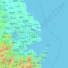
Shanghai
The golden age of Shanghai began with its elevation to municipality after it was separated from Jiangsu on 7 July 1927. This new Chinese municipality was 494.69 square kilometers (191.00 sq mi), and included the districts of Baoshan, Yangpu, Zhabei, Nanshi, and Pudong. Headed by a Chinese mayor and municipal…
Average elevation: 13 m
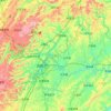
Jishou
Jishou lies east of the Wuling Mountain range. About 80% of the city's terrain is low hills or low mountains. The highest elevation is 964.5 meters, at Liantaifeng (莲台峰; 蓮台峰), near the town of Aizhai (矮寨) and the lowest point is 142 meters, near the town of Hexi (simplified Chinese: 河溪镇;…
Average elevation: 447 m
Beijing
Beijing is situated at the northern edge of the roughly triangular North China Plain, which opens to the south and east of the city. Mountains to the north, northwest and west shield the city and northern China's agricultural heartland from the encroaching desert steppes. The northwestern part of the…
Average elevation: 460 m
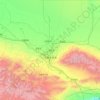
Ürümqi
The largest city in western China, Ürümqi has earned a place in the Guinness Book of Records as the most remote city from any sea in the world. It is about 2,500 kilometres (1,600 mi) from the nearest coastline as Ürümqi is the closest major city to the Eurasian pole of inaccessibility, although Karamay…
Average elevation: 1,294 m


Fengning Manchu Autonomous County
Fengning has a rather dry, monsoon-influenced humid continental climate (Köppen Dwa), with long, very cold and dry winters, and hot, humid summers, and the elevation depresses temperatures. The monthly 24-hour mean temperature in January is −10.6 °C (12.9 °F), and in July it is 22.6 °C (72.7 °F), while…
Average elevation: 1,167 m


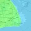
Shanghai
The golden age of Shanghai began with its elevation to municipality after it was separated from Jiangsu on 7 July 1927. This new Chinese municipality covered an area of 494.69 km2 (191.0 sq mi), including the modern-day districts of Baoshan, Yangpu, Zhabei, Nanshi, and Pudong, but excluded the foreign…
Average elevation: 12 m