Bogota topographic map
Click on the map to display elevation.
Bogota
The city is located in the center of Colombia, on a high plateau known as the Bogotá savanna, part of the Altiplano Cundiboyacense located in the Eastern Cordillera of the Andes. Its altitude averages 2,640 meters (8,660 ft) above sea level. Subdivided into 20 localities, Bogotá covers an area of 1,587 square kilometers (613 square miles) and enjoys a consistently cool climate throughout the year.
About this map
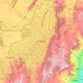
Name: Bogota topographic map, elevation, terrain.
Average elevation: 2,711 m
Minimum elevation: 1,503 m
Maximum elevation: 3,653 m
Other topographic maps
Click on a map to view its topography, its elevation and its terrain.
Cerro de Monserrate
Colombia > Bogota, Capital District
Both Monserrate and its neighbor Guadalupe Hill are icons of Bogota's cityscape. The hill is a tourist attraction with access by funicular or cable car (both of which charge a fee) or the pilgrimage hiking trail (free). The hiking path is 2.4 km (1.5 mi), where you can walk up the steep hill on a journey that…
Average elevation: 2,884 m