
Thank you for supporting this site ❤️
Make a donation
Make a donation
Gear up for your next adventure:
As an Amazon Associate, this site earns from qualifying purchases at no extra cost to you.
Honesdale topographic map
Click on the map to display elevation.
Thank you for supporting this site ❤️
Make a donation
Make a donation
Gear up for your next adventure:
As an Amazon Associate, this site earns from qualifying purchases at no extra cost to you.
About this map
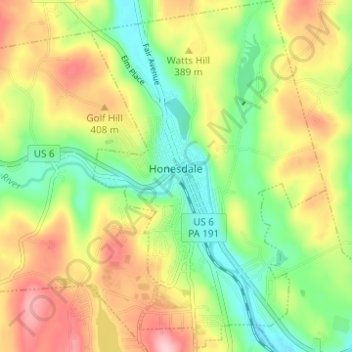
Name: Honesdale topographic map, elevation, terrain.
Location: Honesdale, Wayne County, Pennsylvania, 18431, United States (41.55261 -75.27371 41.59877 -75.23246)
Average elevation: 367 m
Minimum elevation: 283 m
Maximum elevation: 472 m
Thank you for supporting this site ❤️
Make a donation
Make a donation
Gear up for your next adventure:
As an Amazon Associate, this site earns from qualifying purchases at no extra cost to you.