Geolocate

Viewpark topographic map

Click on the map to display elevation.

About this map

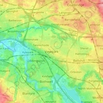
Name: Viewpark topographic map, elevation, terrain.

Location: Viewpark, North Lanarkshire, Scotland, G71 6HL, United Kingdom (55.78602 -4.10061 55.86602 -4.02061)

Average elevation: 62 m

Minimum elevation: 10 m

Maximum elevation: 140 m

Gear up for your next adventure:

🧣Merino Neck Gaiter - Protects against wind, sun, and cold at high altitudes
🧴Insect Repellent - Protect yourself from bugs during outdoor adventures
👖Convertible Hiking Pants - Zip-off legs to adapt to changing weather conditions
🥾Hiking Gaiters - Protect legs and shoes from mud, snow, and debris
🧊Insulated Water Bottle - Keeps drinks cold in summer and prevents freezing in winter

As an Amazon Associate, this site earns from qualifying purchases at no extra cost to you.