
Make a donation
Gear up for your next adventure:
As an Amazon Associate, this site earns from qualifying purchases at no extra cost to you.
Chambersburg topographic map
Click on the map to display elevation.
Make a donation
Gear up for your next adventure:
As an Amazon Associate, this site earns from qualifying purchases at no extra cost to you.
Chambersburg
Chambersburg is served by the Lincoln Highway, U.S. 30, between McConnellsburg and Gettysburg. U.S. 11, the Molly Pitcher Highway, passes through it between Shippensburg, Pennsylvania, and Hagerstown, Maryland. Interstate 81 skirts the borough to its east. The town lies approximately midpoint on US Route 30 between Pittsburgh and Philadelphia. The local topography reflects both flatter areas like Philadelphia and mountainous areas like Pittsburgh. Downtown Chambersburg has occasional events such as Food Truck Festival and Apple Fest.
Make a donation
Gear up for your next adventure:
As an Amazon Associate, this site earns from qualifying purchases at no extra cost to you.
About this map
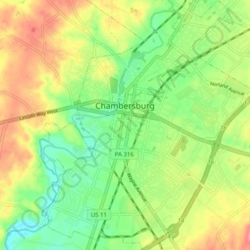
Name: Chambersburg topographic map, elevation, terrain.
Location: Chambersburg, Franklin County, Pennsylvania, United States (39.90580 -77.68568 39.96065 -77.62369)
Average elevation: 200 m
Minimum elevation: 166 m
Maximum elevation: 241 m
Make a donation
Gear up for your next adventure:
As an Amazon Associate, this site earns from qualifying purchases at no extra cost to you.