Geolocate

Kalpa topographic map

Click on the map to display elevation.

About this map

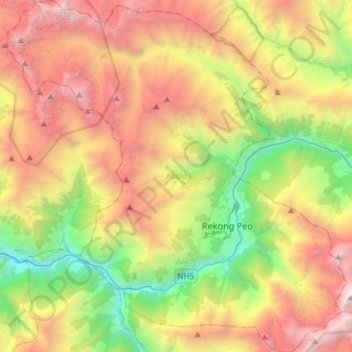
Name: Kalpa topographic map, elevation, terrain.

Location: Kalpa, Kinnaur district, Himachal Pradesh, India (31.45254 78.08760 31.70137 78.36968)

Average elevation: 3,777 m

Minimum elevation: 1,671 m

Maximum elevation: 6,458 m

Other topographic maps

Click on a map to view its topography, its elevation and its terrain.

Kalna

India > Himachal Pradesh > Kinnaur district > Yuwarangi

Average elevation: 2,386 m

Gear up for your next adventure:

📷Outdoor Action Camera - Capture high-elevation views and rugged adventures
🧣Merino Neck Gaiter - Protects against wind, sun, and cold at high altitudes
🕯️Camping Lantern - Illuminates your entire campsite with high-efficiency LEDs
🧭Orienteering Kit - Tools for map reading and navigation in the wild
🥾Mountain Hiking Shoes - Shoes with superior grip for mountainous terrain

As an Amazon Associate, this site earns from qualifying purchases at no extra cost to you.