
Guelma topographic map
Interactive map
Click on the map to display elevation.
About this map
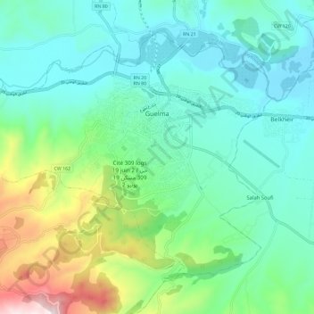
Name: Guelma topographic map, elevation, terrain.
Location: Guelma, Guelma District, Guelma, 24000, Algeria (36.41560 7.35787 36.48888 7.47259)
Average elevation: 349 m
Minimum elevation: 171 m
Maximum elevation: 917 m
Other topographic maps
Click on a map to view its topography, its elevation and its terrain.