Geolocate

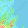
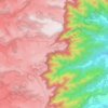
Imaruí topographic map

Click on the map to display elevation.

About this map

Name: Imaruí topographic map, elevation, terrain.

Location: Imaruí, Região Geográfica Imediata de Tubarão, Região Geográfica Intermediária de Criciúma, Santa Catarina, South Region, Brazil (-28.36134 -48.95900 -28.07159 -48.72427)

Average elevation: 147 m

Minimum elevation: -3 m

Maximum elevation: 874 m

Other topographic maps

Click on a map to view its topography, its elevation and its terrain.
Três Picos

Brazil > Santa Catarina

Average elevation: 795 m

Residência Fuck

Brazil > Santa Catarina > Monte Castelo

Average elevation: 845 m

Córrego do Fuck

Brazil > Santa Catarina > Canoinhas

Average elevation: 786 m

Serra da Bateia

Brazil > Santa Catarina > Guabiruba

Average elevation: 339 m

Alto Pitanga

Brazil > Santa Catarina > Nova Trento

Average elevation: 427 m

Palhocinha

Brazil > Santa Catarina > Trombudo Central

Average elevation: 391 m

Pericó

Brazil > Santa Catarina > São Joaquim

Average elevation: 1,239 m

Gear up for your next adventure:

🥾Trekking Boots - Durable boots for long-distance trekking
🛶Kayak Dry Bag - Waterproof storage for kayaking adventures
🏃Hydration Running Vest - Carry water and maps close to your body for speed
⛺Camping Tent - Weather-resistant tents suitable for 2 to 6 people
🥾Hiking Shoes - Durable and comfortable shoes for trail hiking

As an Amazon Associate, this site earns from qualifying purchases at no extra cost to you.